The new London Underground map is out (March 2011 edition)
[UPDATE: Another update of the London tube map came out in April 2011, with Tottenham Court Road migrating westwards, and a further update in August 2011.]
Yesterday was my first sighting of the latest edition of the London Underground’s Tube map, March 2011 edition. The main change is the addition of the new stretch of London Overground line running from Dalston through to Highbury and Islington:
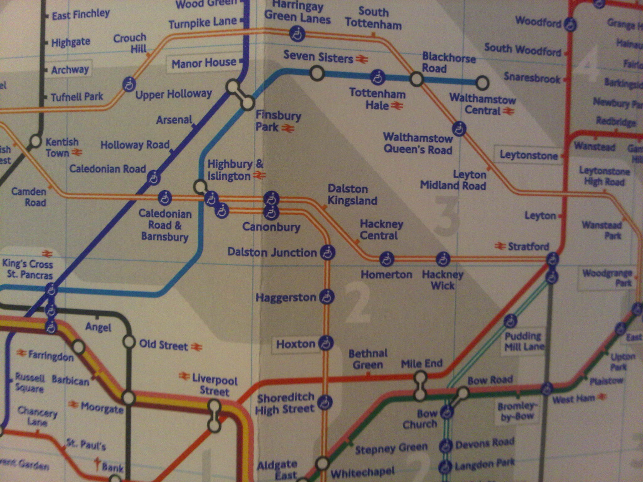
Also of note is what I think is a lovely little touch of improved design further south. The Overground line running down to Crystal Palace and West Croydon has moved fractionally to the left – for no apparent reason other than it therefore doesn’t quite rest on one of the folds of the map. That in turn keeps the map a bit more readable if your fold gets heavily worn – as my previous edition of the map demonstrates.
Otherwise, it’s pretty much same as before though the grey shading is darker, there is a continuing reduction in the use of red daggers (on which in particular see this discussion) to indicate special information about specific stations, the lines around Stratford have been tweaked ahead of further changes in the system and a couple of stations on the North London line as way have moved a little to make the layout clearer.
Leave a Reply