The new London tube map (August 2011 version)
Two recent changes have triggered the production of a new version of the London tube (plus London Overground) map: the opening of the latest (and most likely last for the foreseeable future) extension of the DLR plus the creation of an additional version of the “step free access” wheelchair logo. This means that the Tube map now distinguishes between stations with step free access to trains and stations where the step free access only extends as far as the platforms but you will have a step up or down to the trains themselves.
You may have noticed the two versions of the wheelchair logo starting to appear in the maps on stations and in trains, although so far the new map does not seem to have made it into any of the piles of printed maps found on the London Underground network. The online pdf of the London tube map has however been updated.
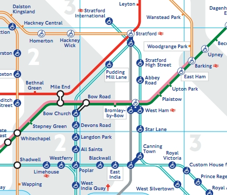
Here is the section showing the new DLR stations along with some of the new logos. Say hello to two new stations with Stratford in their title (it’s all going a bit Harrow out in East London), along with Abbey Road and Star Lane stations. There is also a slight shuffle to the west for Royal Victoria and a straightening out of the DLR around Poplar:
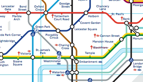
The use of two logos for step free access also means stations such as Green Park and Westminster have grown from one circle to two:
I'm not sure Harry Beck would approve. Since the Overground got added it's all looked way too congested – and the last attempt to have different symbols that meant similar things backfired badly. It needs a full redesign between Zone 1 and Zone 4, maybe with thinner lines.
A question: how to reach Stansted Airport from Great London early in the morning from Manor House Station (Piccadilly Line)?
stansted express da liverpool street https://www.stanstedexpress.com/index.asp?SID={6ED5640F-B7A5-4A65-84C5-B2EC851299B2}